The Amalfi Coast is a road, and almost everything written about it treats it as scenery. That is the pattern I keep noticing when I open the small library of Costiera books we keep at the studio: the coast is described as if it had always been drivable, always been reachable, always been the light-drenched cliff-village necklace that fits inside a rental convertible. It hasn't. Before the middle of the nineteenth century, there was no continuous road along the cliffs between Vietri sul Mare and Positano. There were mule paths, fishing coves, and a maritime republic that had lived by sea for eight hundred years. The modern Amalfi Coast — the one people photograph, drive and post — is a byproduct of a Bourbon public works project, finished in stages around 1852. Most books won't say that in their first chapter. So we will.
The Pattern of the Timeless Cliff
The first pattern is the one every travel book on the Costiera performs without noticing: the coast is treated as eternal. Positano was always Positano, Amalfi was always Amalfi, and the reader is invited to picture the pastel houses stacked into the rock as if that stack had been the point since antiquity.
The historical record is stranger than that. Amalfi was one of the four Italian maritime republics — alongside Venice, Genoa and Pisa — and its wealth peaked between the ninth and eleventh centuries, drawn from trade with Byzantium and the eastern Mediterranean. The coastal villages faced outward. They faced the sea because the sea was the road. Land access between one village and the next was slow, steep and often unnecessary. A cargo of paper from the mills at Amalfi could reach Naples faster by boat than a mule could reach the next cove.
When Norman Douglas wrote about the Sorrento peninsula in *Siren Land* in 1911, or when Goethe crossed south to Paestum in his *Italian Journey* a century earlier, they were describing a landscape that was still legible from the sea and only partially from the land. Read those books today alongside a modern Costiera guide and you will see the modern one quietly assuming a coast that the older ones did not yet inhabit. The books changed because the road changed the coast.
The Pattern of the Missing Engineer
The second pattern is who gets credited. Open almost any Costiera memoir and it will name painters, filmmakers, expatriate novelists, hoteliers and at least one waiter who was rude to the author in 1978. It will not name a single road engineer.
The road we now call the Strada Statale 163 Amalfitana was commissioned by the Bourbon government of the Kingdom of the Two Sicilies. Ferdinand II funded its extension along the cliffs; the Corpo di Ponti e Strade — the Bourbon corps of bridges and roads — designed it. It was built in stages, cut into limestone by masons whose techniques were closer to quarrying than to anything a modern civil engineer would recognise. The final continuous section between Vietri sul Mare and Positano was opened around 1852.
There is a specific and slightly absurd fact hidden in that sentence: the road half the world now considers the most beautiful drive on earth is a piece of pre-unification Italian statecraft. The Bourbons were not thinking about tourism. They were thinking about administration, tax collection and troop movement along a chronically hard-to-reach province. The scenic route is a byproduct of a bureaucratic problem being solved. The books, almost without exception, either skip this or reduce it to a sentence.
The Costiera was drawn by masons before it was drawn by artists, and both drawings are the same thing: sections cut into limestone until a coast becomes legible.
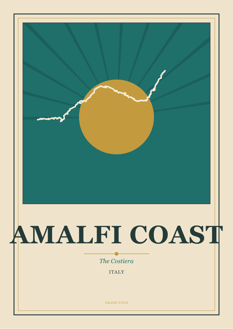 Amalfi Coast
The print from this article · from €29.95
View the print →
Amalfi Coast
The print from this article · from €29.95
View the print →
The Pattern of the Ravello Detour
The third pattern is subtler and more revealing. Books about the Amalfi Coast keep giving Ravello a starring role — the composers who came, the writers who stayed, the villas with the impossible views — while treating it as a coast town. Ravello is not on the coast. It sits roughly three hundred and fifty metres above it, on a spur between two valleys, reachable only by climbing away from the water.
This is a fact about geography that the road quietly recodes. Once the SS163 exists and the local roads climb up to Ravello from it, Ravello begins to behave, in the reader's mind, as if it were part of the Costiera. Wagner composed the Klingsor garden sketch from *Parsifal* at Villa Rufolo in the summer of 1880 — a documented visit — and the modern reader files that visit under "Amalfi Coast" even though Wagner was on a hilltop far from the shoreline. Gore Vidal spent decades at La Rondinaia above the same cliffs, and the books that describe his years there rarely mention that the terrace he wrote from was not on the coast at all. It was above it.
The pattern here is the road doing something that mule paths never did: gathering scattered geographies into a single legible object called "the Costiera." The books inherit that object without questioning it. Ravello is a hill town that got included when the road climbed to it.
The Pattern of the Poster That Wasn't Made
The fourth pattern is one we notice from the drafting table. Go through the golden age of European travel posters — the great lithographic run from roughly the 1890s to the 1950s — and the Amalfi Coast is strikingly under-represented compared to the French Riviera, the Italian Lakes, Venice and even Capri. Posters of it exist, but not the canonical archive that other Mediterranean stretches enjoy.
There is a straightforward reason. The great travel posters of that period were mostly commissioned by railway companies. Rail lines needed passengers, and posters told the public where the train could take them. The Naples–Salerno line existed inland. But the coast itself has no railway, and it never did. The road, not the rail, made this coast accessible in the modern sense — and the road did not commission the same volume of graphic art.
The Costiera therefore entered the twentieth-century visual canon later and through a different door: photography and post-war cinema. Steinbeck's short essay *Positano*, published in *Harper's Bazaar* in May 1953, belongs to that door, not the poster door. When we sit down at the studio to draw an Amalfi plate, we are giving the coast the poster it never quite received — and that gap in the archive is not an accident. It is a function of how the road came into being. Prints of the places discussed in this piece are at our /shop/.
 Venice
The print from this article · from €29.95
View the print →
Venice
The print from this article · from €29.95
View the print →
So What Do You Actually Do
Read the road, not the beach. When you look at the Amalfi Coast, understand that what you are seeing is engineered legibility — a nineteenth-century state project that turned a sea-facing archipelago of villages into a linear necklace visible from a car window. The books that treat the coast as timeless are describing an experience that has existed for roughly one hundred and seventy years, not eight hundred.
If you drive the SS163, notice the sections. Notice where the road cuts into cliff and where it corbels out over air. Notice how villages that face the sea have their backs to the road, because they were built before the road was there. When you look at the coast from a boat, you are seeing the older geography — the one Amalfi's shipowners knew. When you look at it from a rented convertible, you are inside a piece of Bourbon public works.
None of this tells you what happens to a coast whose scenic route has become its central identity. That is the real question at the Costiera in 2026 — a question about density, preservation and what the road, having invented the modern coast, is now doing to it. That question is where the next piece of work begins, and it is not where this one ends.
FAQ
When did the Amalfi Coast road actually open?
The Strada Statale 163 Amalfitana was built in stages by the Bourbon Kingdom of the Two Sicilies, with the final continuous cliff section between Vietri sul Mare and Positano opening around 1852. Earlier segments existed in the 1830s and 1840s. The point is that the modern experience of driving the Costiera — cove to cove without leaving the cliffs — is a mid-nineteenth-century invention, not an ancient one, and it predates Italian unification by almost a decade.
How was the Amalfi Coast reached before the road existed?
By sea, and by mule paths climbing to inland routes. The villages were built facing outward because the sea was the road. Amalfi itself, as one of the four Italian maritime republics, ran a shipping economy that reached Byzantium and the Levant; overland travel between neighbouring coves was often slower than a boat trip to Naples. Land access existed but was slow, steep and secondary to maritime traffic for most of the coast's history.
Why is Ravello treated as an Amalfi Coast town if it sits inland and above the sea?
Because the road did that, not geography. Ravello sits roughly three hundred and fifty metres above the shoreline, on a spur between two valleys. Once the SS163 existed and local roads climbed up to Ravello from it, the town was folded into the modern conception of the Costiera. Wagner's documented 1880 stay at Villa Rufolo and Gore Vidal's later decades at La Rondinaia are both filed under "Amalfi Coast" in the popular imagination, but both men looked at the sea from a hilltop.
Why did the golden age of travel posters largely skip the Amalfi Coast?
The great European travel posters from the 1890s to the 1950s were mostly commissioned by railway companies, and no railway runs along the Amalfi Coast. The Naples–Salerno line existed inland, but the coast itself was road-only. The Costiera entered the visual canon later, through photography and post-war cinema rather than lithographic posters — which is why its poster archive feels notably thinner than the Riviera's or Venice's for the same period.
What was the Amalfi maritime republic and how does it relate to the coast we see today?
Amalfi was one of the four Italian maritime republics, alongside Venice, Genoa and Pisa, peaking between the ninth and eleventh centuries on trade with the eastern Mediterranean. That maritime past explains why the coastal villages were built facing the water: the sea was the trade route, not the land. The coast a modern traveller sees from the road is a different orientation of the same villages — the seaward face turned into a spectacle by a cliff road that came eight centuries later.
Is the Amalfi Coast road really as narrow and vertiginous as its reputation suggests?
It is narrow because it was cut into limestone cliffs in the middle of the nineteenth century, using techniques closer to quarrying than to modern civil engineering, and it was not designed for two-way tourist coach traffic. The hairpins, blind curves and one-vehicle stretches are original features of a road built for a very different vehicle load. What has changed since 1852 is the traffic, not the road.
What should I read about the Amalfi Coast if most books repeat the same patterns?
Read outside the coastal memoir shelf. Norman Douglas's *Siren Land* (1911) treats the Sorrento peninsula before the modern road did all of its work. Goethe's *Italian Journey* describes a southern Italy that predates the Costiera as a concept. And Steinbeck's short essay *Positano*, published in *Harper's Bazaar* in May 1953, is worth reading precisely because it belongs to the moment the coast enters the twentieth-century visual canon — the moment the road, the boats and the cameras all met.
New city prints and 10% off your first order.
One email now with your code. No noise after.