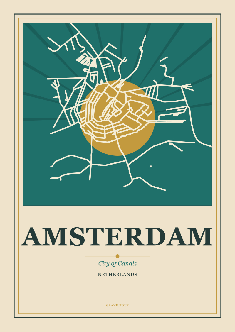
Amsterdam is one of the few great cities whose ground plan can be recognised at a glance. The concentric arcs of its canal ring — Singel, Herengracht, Keizersgracht, Prinsengracht — hold the old town in a half-moon of water pulled tight against the IJ. This is not the geometry of a place that grew by accident. The canal belt was plotted in the seventeenth century as a piece of urban design, an expansion drawn on paper before it was dredged, and the shape it took still governs how the city is read from above four hundred years later.
We spend a lot of time at the desk with Amsterdam because it is one of the rare European cities that survives the flattening of an overhead view. Most old towns are legible only at eye level; from above they resolve into a beige knot of tiles. Amsterdam does the opposite. It is a city made for the plan drawing, which is another way of saying it was made from one.
The Half-Moon on the Map: Reading Amsterdam From Above
Pull up any map of central Amsterdam and the shape reveals itself before you register a single street name. A curve of water opens to the north against the IJ, the broad inland arm that used to be an open bay, and closes back toward it in a symmetrical sweep. Inside that outer curve, three more curves sit nested one within the other, evenly spaced, each following the same governing arc. The effect is of a bow drawn tight, with the medieval core of the city held as the arrow at its centre.
The four principal canals are not decorative rings around a plaza. They are the plan. From the outside in, the Prinsengracht — the Prince's Canal — traces the widest arc. Inside it lies the Keizersgracht, the Emperor's Canal. Then the Herengracht, the Gentlemen's Canal, which was the address of choice for the city's wealthiest merchants and remains so in memory if not always in fact. And finally the Singel, tighter still, which began life as a medieval moat and predates the great plan by centuries. Beyond the Prinsengracht sits the Jordaan, a working-class district that was folded into the expansion but drawn on a different, more utilitarian grid.
What you see from above is unusual because it is coherent. Paris grew by absorption, its old villages left as neighbourhoods with their own street logic. London is essentially unplanned, a collision of parish patterns. Rome is a palimpsest. Amsterdam, by contrast, was drawn once and executed. The half-moon on the map is the direct trace of a decision — the trace of a decision to draw a city rather than let one accumulate.
Before the Grachtengordel: A Settlement on Peat and Tide
To understand why the plan exists you have to understand the place before the plan. Amsterdam was not always the geometrically confident city we now recognise. For most of its early history it was a small fishing and trading settlement at the mouth of the Amstel, where the river met the open water of the IJ. Its ground was peat: soft, waterlogged, compressible, and inclined to sink whenever it was drained or built on. The name of the city preserves this origin. The Amstel was dammed here in the thirteenth century, and the settlement that grew around that dam took its name from the fact of it — a dam on the Amstel.
Everything that follows in Amsterdam's history is shaped by that ground. Building on peat means building on piles. The houses of the canal ring stand on long wooden trunks driven down through the soft upper layers until they reach a firmer sand stratum below. The characteristic tilt of certain façades on the Herengracht is not affectation; it is the record of piles settling unevenly over centuries. The city floats, in a sense, on a forest of buried timber.
By the late sixteenth century, Amsterdam had outgrown its medieval walls. The Dutch Revolt against Spanish rule had redrawn the map of European commerce, and a great deal of that commerce — capital, merchants, printers, refugees from Antwerp — was pouring into a city that had no room to receive it. The population was rising sharply. The old town was congested. The wharves along the IJ were overburdened. The city's magistrates were faced with a decision that most European cities in that period simply did not confront: to expand, they would have to make new ground. Peat had to be drained, canals had to be dug to drain it, and streets had to be raised on the material dug out. Expansion here was not the loosening of a wall. It was hydraulic engineering.
 Amsterdam
The print from this article · from €29.95
View the print →
Amsterdam
The print from this article · from €29.95
View the print →
Why the Canals Curve: The Logic of the Seventeenth-Century Plan
The decision, taken in stages through the early seventeenth century and executed over the next several decades, was to add not one but a series of parallel canals to the outer edge of the city, following the curve of the existing medieval moat. The logic of the curve is worth pausing on because it is often mistaken for aesthetic preference. It is instead the calm consequence of two constraints.
The first is that the medieval city was already a curved shape, pressed against the IJ. If you want to expand outward from a curve while keeping every new street the same walking distance from the water, you end up with concentric arcs. A grid would have forced parts of the new city into awkward relationships with the old wall. The arc respected what was already there.
The second constraint is more interesting. The canals were not only ornamental waterways for barges and merchant houses; they were the drainage system that made the expansion possible in the first place. Every metre of new dry land had to be lifted above the water table by digging channels around it. The excavated material became the foundation of the streets and building plots between the canals. In other words, the canals had to be there for the plots to exist. Their curve, their spacing, and their depth were all functions of drainage before they were functions of commerce or beauty. That the result is beautiful is a windfall of a plan that solved a hydrological problem first.
Between the canals, the planners laid a set of radial streets — connectors running perpendicular to the arcs — that let traffic move across the rings rather than always with them. The whole system produced a grid of plots that could be sold to private developers under strict conditions: façade widths, cornice heights, allowed materials, even the depth of the gardens behind. What looks in a photograph like organic variety along the Herengracht is variety within a very tight rule.
The Four Rings and What Each One Was Built to Do
The four canals of the ring were not equivalent. Each had a role.
The Singel is the oldest and the anomaly. It was already there when the great plan began — the medieval defensive moat that had ringed the city since the fifteenth century. The planners kept it and made it the innermost arc of the new figure, absorbing a defensive line into a residential and commercial belt. Its houses face the old town on one side and the new expansion on the other, which is why walking along it feels like walking a seam.
The Herengracht was the prestige address. Along the stretch known as the Golden Bend, plots were larger, façades were wider, and the merchant houses that went up on them were the most elaborate the city produced. This was the canal of the regenten — the merchant elite who ran the East India Company and the city itself — and its architecture was designed to advertise their standing without breaking the plan's rules on cornice heights. The result is a certain restrained grandeur, opulence held inside a uniform envelope.
The Keizersgracht sat one ring out, wider than the Herengracht by several metres of water, and served a slightly less exalted tier of merchants and professionals. Its width was itself a form of luxury — more sky, more reflected light, longer sightlines down the canal.
The Prinsengracht, the outermost of the four, was more mixed in use. Warehouses, breweries, workshops, and modest houses lined it, alongside grander residences. It was the working edge of the plan, the seam between the ordered rings and the different logic of the Jordaan beyond. And because it was the outermost, it drew a great deal of the traffic that would otherwise have clogged the inner canals — a plan detail that the city has quietly benefited from ever since.
Together the four canals produced roughly a hundred kilometres of quay, a stock of merchant houses that the Netherlands has spent four hundred years learning to preserve, and a hierarchy of address so legible that Amsterdammers still read a person's canal before they read the number on the door.
 Rome
The print from this article · from €29.95
View the print →
Rome
The print from this article · from €29.95
View the print →
Why Amsterdam Draws So Well: The City as a Composition
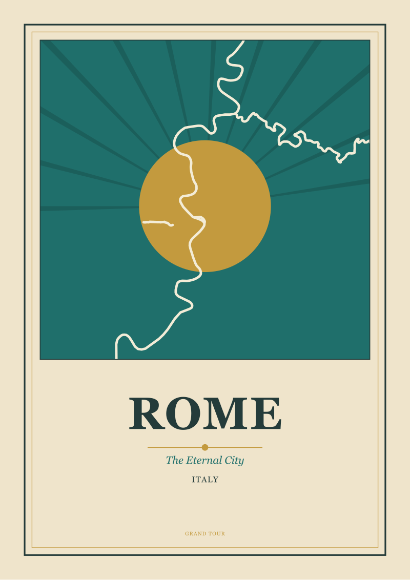
We come back, as we always do at this desk, to the question of how a place composes on paper. Some cities resist the flat page: their power is in the encounter, the surprise turn, the way a piazza opens when you did not expect it. Rome is like this. So is Prague. They lose something when reduced to a plan drawing, and the poster tradition has always struggled with them at that scale, preferring instead to isolate a single monument.
Amsterdam is the opposite case. It composes almost too easily. The half-moon of the canal ring is a shape a designer would draw if asked to invent a memorable city plan from scratch, and this is precisely why the city rewards the overhead view, the axonometric, the sectional drawing, the schematic map. The plan is already halfway to a graphic.
For the poster tradition, this has always been an invitation. A city that is already a legible figure needs no simplification to become a symbol. You can draw the ring in a single confident sweep and it is unmistakable. You can strip out three-quarters of the streets and the character survives, because the character was in the rings all along. You can render the whole thing in two colours and it still says Amsterdam and nowhere else. This is the same property that makes certain coastlines — Santorini's crescent, the Amalfi bend — endlessly poster-able. Amsterdam happens to be a city that shares it, uniquely among the great European capitals.
The fact that the shape was engineered rather than found does not diminish this. It amplifies it. A coastline is a graphic gift from geology. The Grachtengordel is a graphic gift from the seventeenth century, made deliberately by people who could not have known that four centuries later their drainage plan would be, among other things, one of the most drawable urban figures in Europe. That the plan was practical does not stop it from being beautiful, and that it is beautiful does not stop it from having been, first and foremost, a way to hold back the water.
You can see prints of Amsterdam in our shop — the ring drawn honestly, the way it sits on the map, without the postcard varnish. It is a shape that rewards a careful hand, and one we return to often.

New city prints and 10% off your first order.
One email now with your code. No noise after.